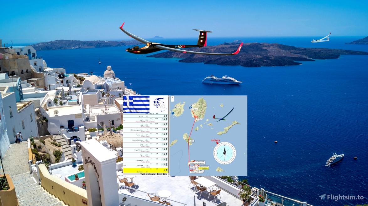

Distance:144km-Duration:45-90mn. .
DG808-AS33me . .
Soaring Type: Ridge
Recommended gliders: Any
Difficulty: ★★☆☆☆
Departure: LGNX Naxos (Rwy 36)
Arrival: LGSR Santorini
Weather report:
Few clouds
20 knots from NW
Notes:
Use the ridges east the airport to gain altitude before the start.
----
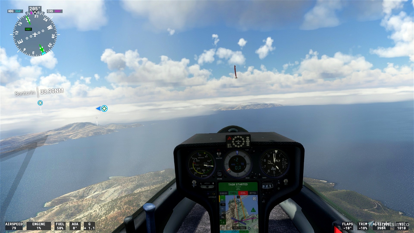
Use and look to GPS to validate all crossing points (notification when done).
Watch your GPS and wait for the map to finish loading.
Then adjust the GPS on the LGNX tab .
Use your catapult to take off.
or
Use your engine to take off.
Use and look to GPS to validate all crossing points (notification when done).
Start your engine to reach 2500 feet.
4000 Maximum height to pass the POI1 start line.
---------------
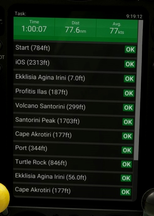
LGNX Naxos 105
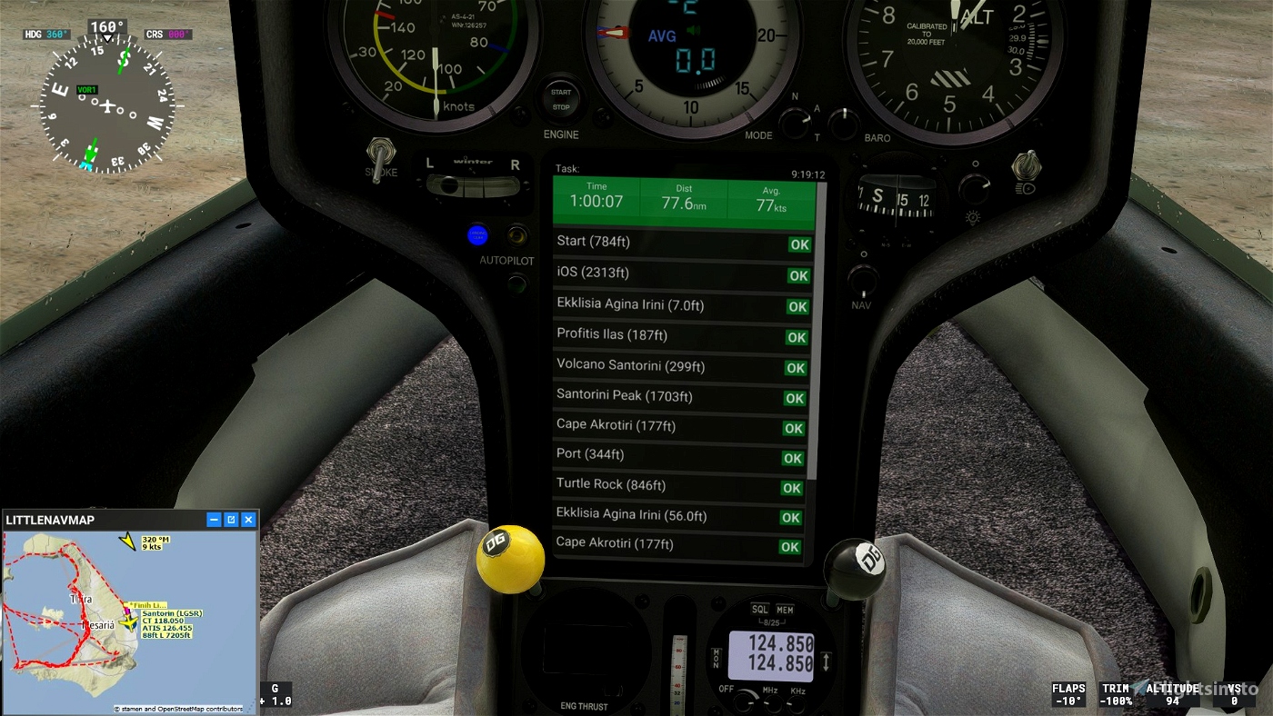
OK go to POI1: Starting line. Elevation 4000 maxi feet
OK go to POI2: iOS+2313x1000
OK go to POI3: Ekklisia Agina Irini+0|1000x1000 Elevation 1000 maxi feet
OK go to POI4: Profitis Ilas+187x1000
OK go to POI5: Volcano Santorini +262x1000
OK go to POI6: Santorini Peak+1660x1000
OK go to POI7: Cape Akrotiri+177x1000
OK go to POI8: Port+492x1000
OK go to POI9: Turtle Rock+846x1000
OK go to POI10: Ekklisia Agina Irini+0x1000
OK go to POI11: Cape Akrotiri+177x1000
OK go to POI12: Port+344x1000
OK go to POI12: Turtle Rock+1024x1000
OK go to POI12: Now visit+0x1000
OK go to POI13: *Finih Line+26x2000
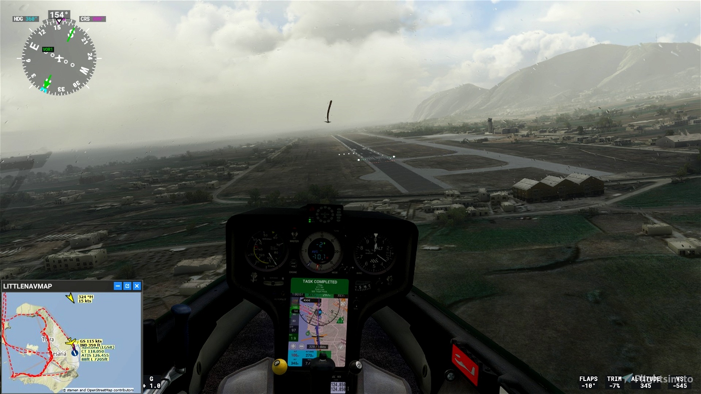
go Landing on Santorini Airport - LGSR 26 feet
Turn off your main battery after landing if you are using the DG808, wait a few minutes to get the trip completed message.

 ADCKillerman

