
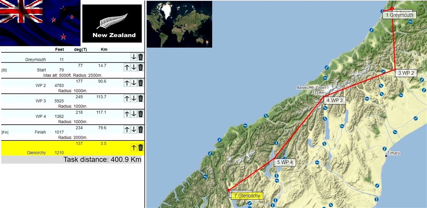

Distance:400km.Length:2h. .
Difficulty: Advanced. ...
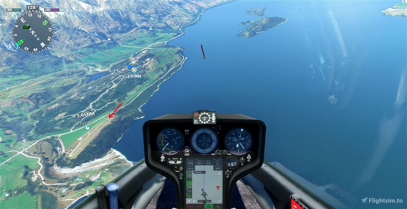
Departure: NZGM
Destination: NZGY
Weather report:
Few clouds
15 kts wind from NW
Notes:
Use the ridges north of the airport to gain altitude before the start.
Second leg is a bit tricky, but it should be smooth sailing after.
autor map and weather : GeorgOrtner
SCC Sim Soaring Club
----
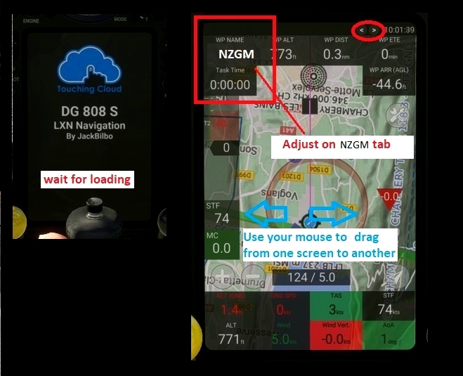
Use and look to GPS to validate all crossing points (notification when done).
Watch your GPS and wait for the map to finish loading.
Then adjust the GPS on the NZGM tab .
Use your catapult to take off. Pull on the yellow handle.
Use your engine to take off.
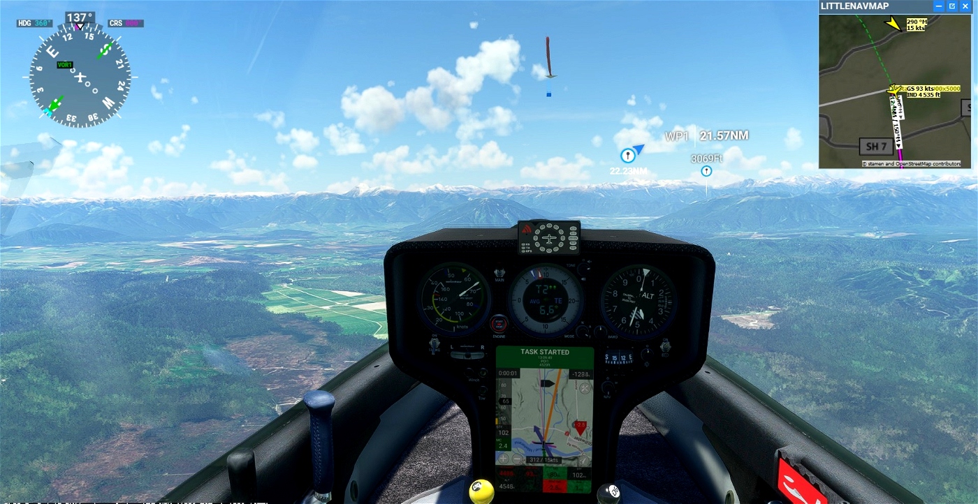
Pass over the aerodrome to valid NZGM
Make sure that you have validated the crossing point above the aerodrome.
5000 feets maximum height to pass the POI1 start line.
----
---------------
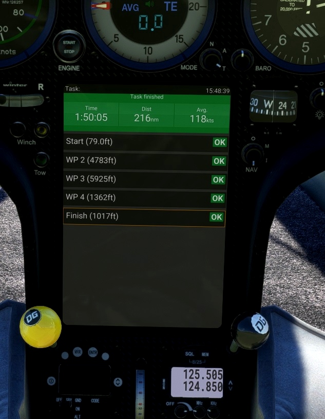
POI1 WP1. Starting line. Elevation 5000. Altidude Maxi 5 000 feet for the best challenge
POI2 WP2. lake coleridge Elevation 4783 feet
POI3 WP3. Hooker lake Elevation 5925 feet
POI4: WP4. Lake Wanaka Elevation 1382 feet
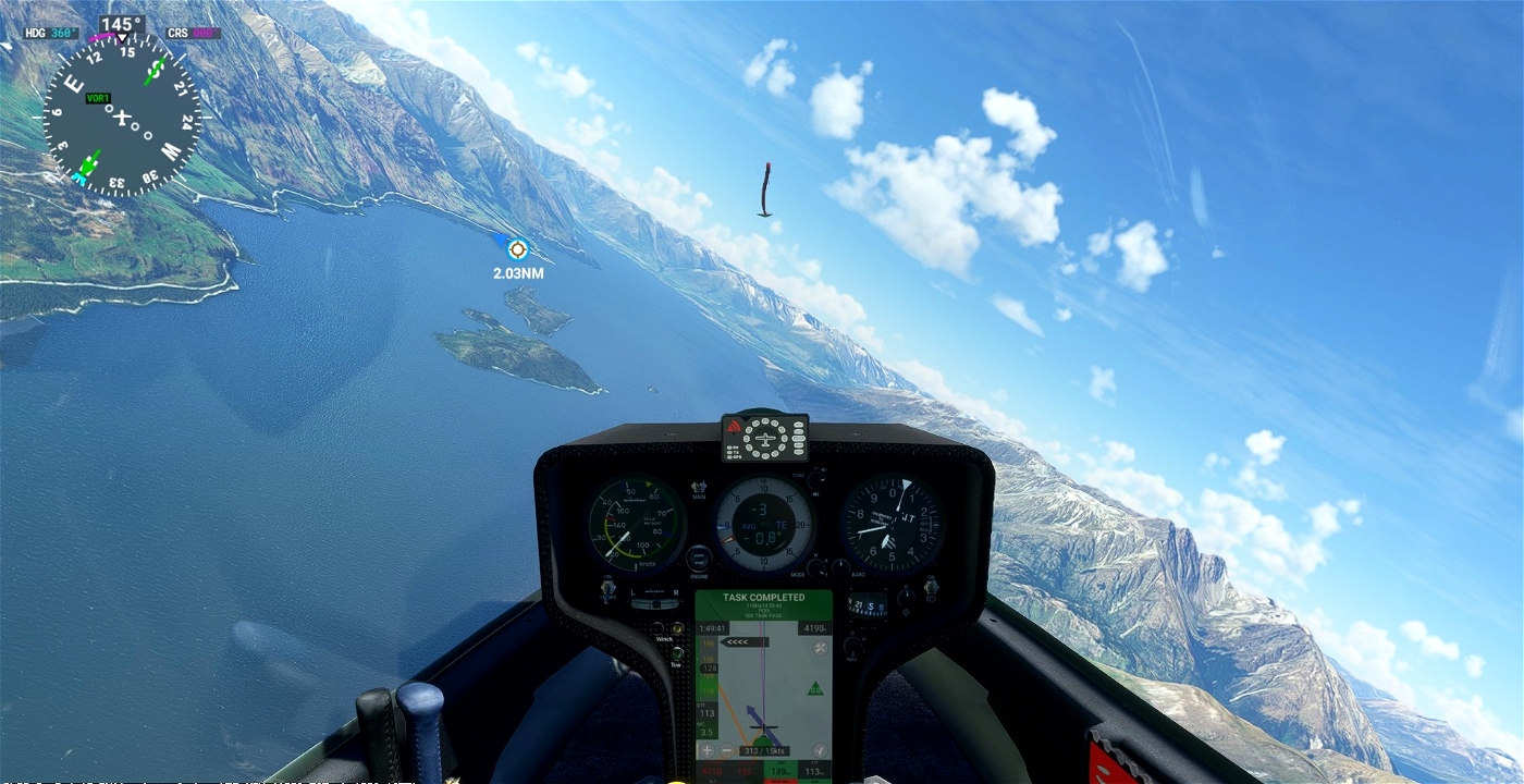
POI5: WP5. Finish line. Elevation 1017 feet
go Landing on Glenorchy Airport - NZGY 1210 feet
Turn off your main battery when you have landed
Recommended mods:
https://orbxdirect.com/product/nz-mesh-msfs
https://flightsim.to/file/19442/glenorchy-airstrip-nzgy
https://discord.gg/T4whEMZp?event=1050705295975927868
autor map and weather : GeorgOrtner
https://discord.com/invite/8TaW8QjH
https://www.youtube.com/GeorgOrtner
https://www.twitch.tv/videos/1534299342
JackBilbo
https://fr.flightsim.to/discover/LXN%20Nav%20Replacement
MSFS ALBATROSS
DG Flugzeugbau DG-808S
https://fr.flightsim.to/file/30384/dg-flugzeugbau-dg-808s
https://msfs.touching.cloud/mods/ms-dg-808s/
https://msfs.touching.cloud/mods/albatross/

 ADCKillerman

