
Slope Soaring Task For MSFS.
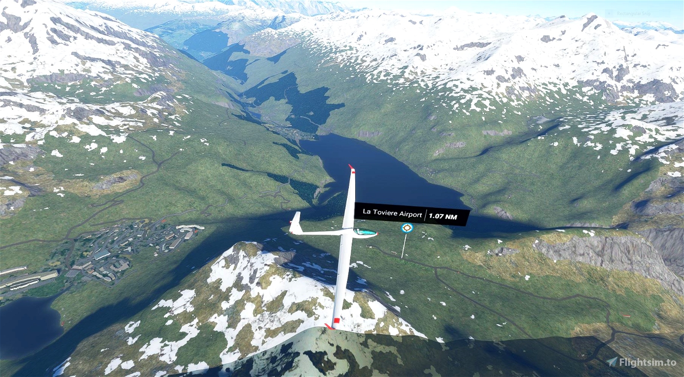
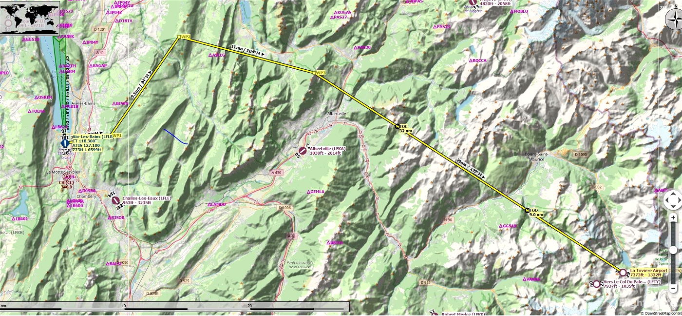
LFLB Aix-Les-Baines to LFTS Toviere Airport.
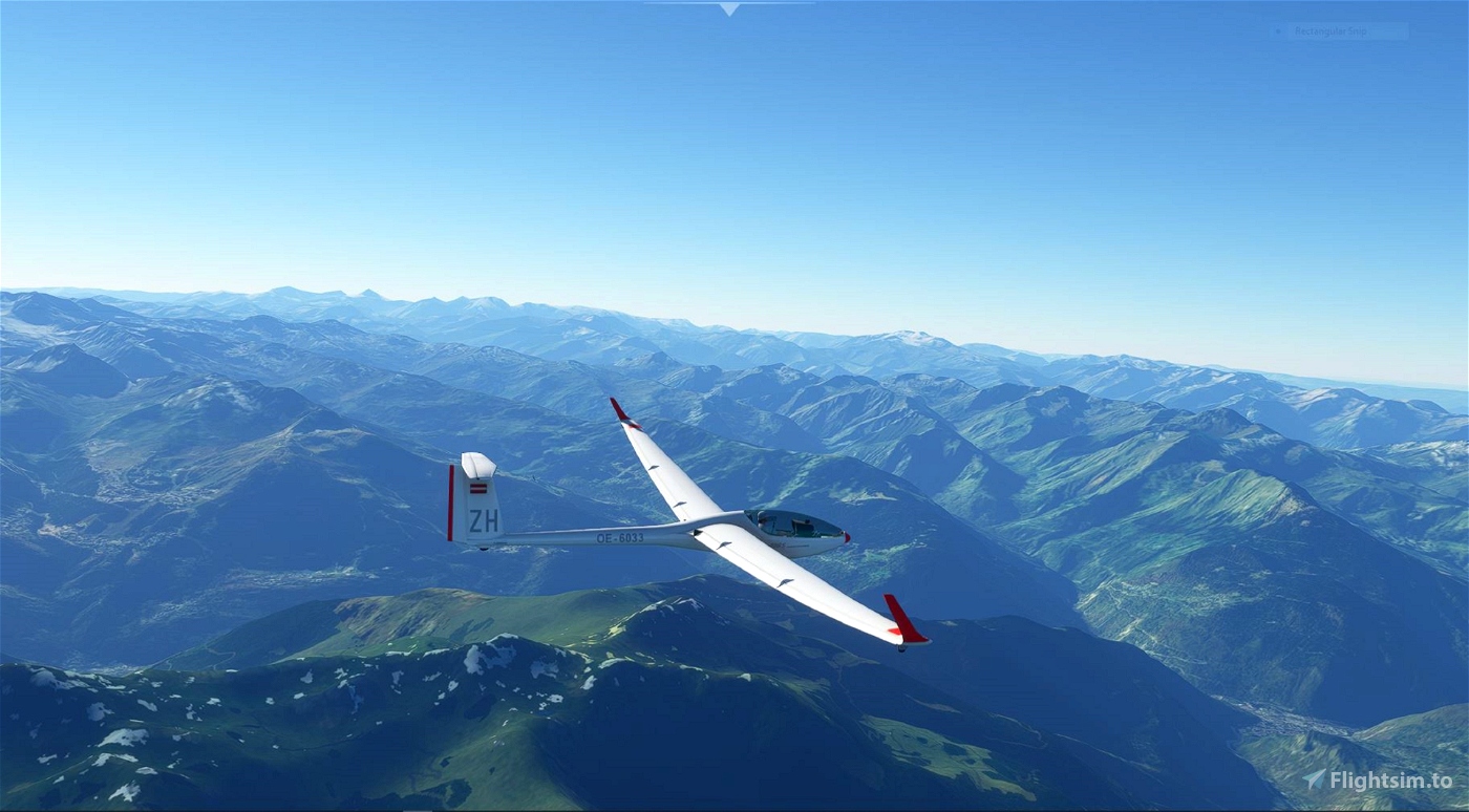
With recent developements in both MSFS and the soaring community at large, as well as enthusiastic third party developers, it is now nearly possible to create a soaring task within MSFS. This is my humble attemt at doing so with the current technology known at this moment in time. Here we will be soaring the scenic French Alps very near Mount Blanc,
The scenery is breathtaking and the flying a challenge to see if you can land at a small alpine airstrip high in the mountains.I have to thank first of all f99mlu creator of BushMissionGen for his help in assisting me with getting some specific coding to allow some very unique features with the Bush Gen app.There are lots of cool features I was able to add, such as TTS (text to voice) alerts and hints as you fly through way points and other areas. There is also an altitude limit to level the flying field for all pilots so no one has an unfair advantage. You will be warned if you exceed this limit, and disqualified if you continue higher.
You will need the Touching Cloud DG808s and Kinetic assistant to fly this task available at: https://msfs.touching.cloud/ Install the sailplane per the instructions and install the stand alone Kinetic assistant, which includes several utilities, but we will only be using the Winch app for this task.
It is also very useful if you use Little Nav Map for navigation, but it is not required. plan files are included.


sonicviz
This no longer shows up in custom content. Is it possible to get the source to build it manually in order to fix and keep up to date? Ditto for the courchevel one too.
andhog
I'm feeling really stupid but I can't seem to get this to work. I have put the french-alps-soaring-task in my community folder but it doesn't show up anywhere in the sim. What am I missing here?
jmhelms
try to launch the flight, my sailplane starts
up against a building and cannot launch...any
help appreciated...
RHB author
3 years ago
sonicviz
I gather you have a tailwind and consequent ridge lift on some ridge faces along that final leg in which to get height to get across the next gap so I suppose that's the game?
Still, a video demonstrating it would be great! thanks.
ps: Can't do it in VR in the bushtrip mode as bushtrip on this one doesn't seem to like the VR livery. Had to load the FP to play in VR, or play the bushtrip in flatscreen mode.
pps: There's also this great toolbar addon for LittleNavMap so you can run it in VR instead of the in game map https://github.com/bymaximus/msfs2020-toolbar-little-nav-map
ppps: You don't need the kinetic assistant with DG-808S to launch, as they have it set up with a jet engine and 1 gal fuel to simulate a tow anyway. Saves loading yet another app. Just apply throttle and take off and climb till it runs out.
RHB author
3 years ago
RHB
In the context of my mission /task, we don't use the .csv in Kinetic assistant or LNM. those are used exclusively if you are trying to inject thermals into the sim, This little Trip" does not. Only native slope lift. So far Kinetic assistant is only used for the winch utility.
My task only uses LNM for the flight plan, tracking the plane in flight and VFR/ topographical information as you fly, in that case you simply open up LNM, load the included flight plan (from the mission pack) in LNM (not needed to load it in the sim) connect to the sim, and then load the bush trip. you will then have the small MSFS moving map in the sim/ bush mission with a rather primitive flight path, and LNM will simultaneously sync with the sim, show your glider and the flight plan.
RHB
Also there is a built in timer for Bush missions so there is a built in clock to record everyone's time. no need for an external app aside from LNM and Kinetic assistant.
There are also Easter Egg messages if you happen on the best course to give you hints about the mission. imbedded in geotagged Text to speech messages as you fly.
zetar