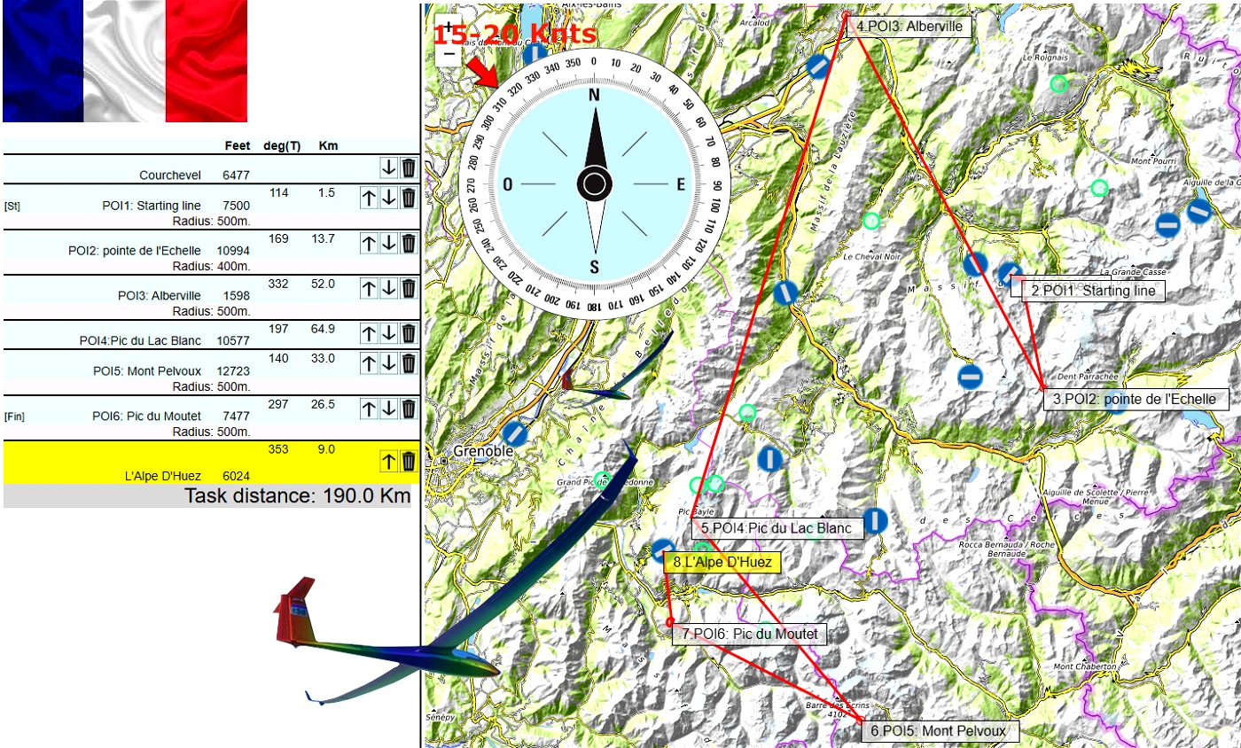

Distance:190.Length:1-2h .
Difficulty:medium ..
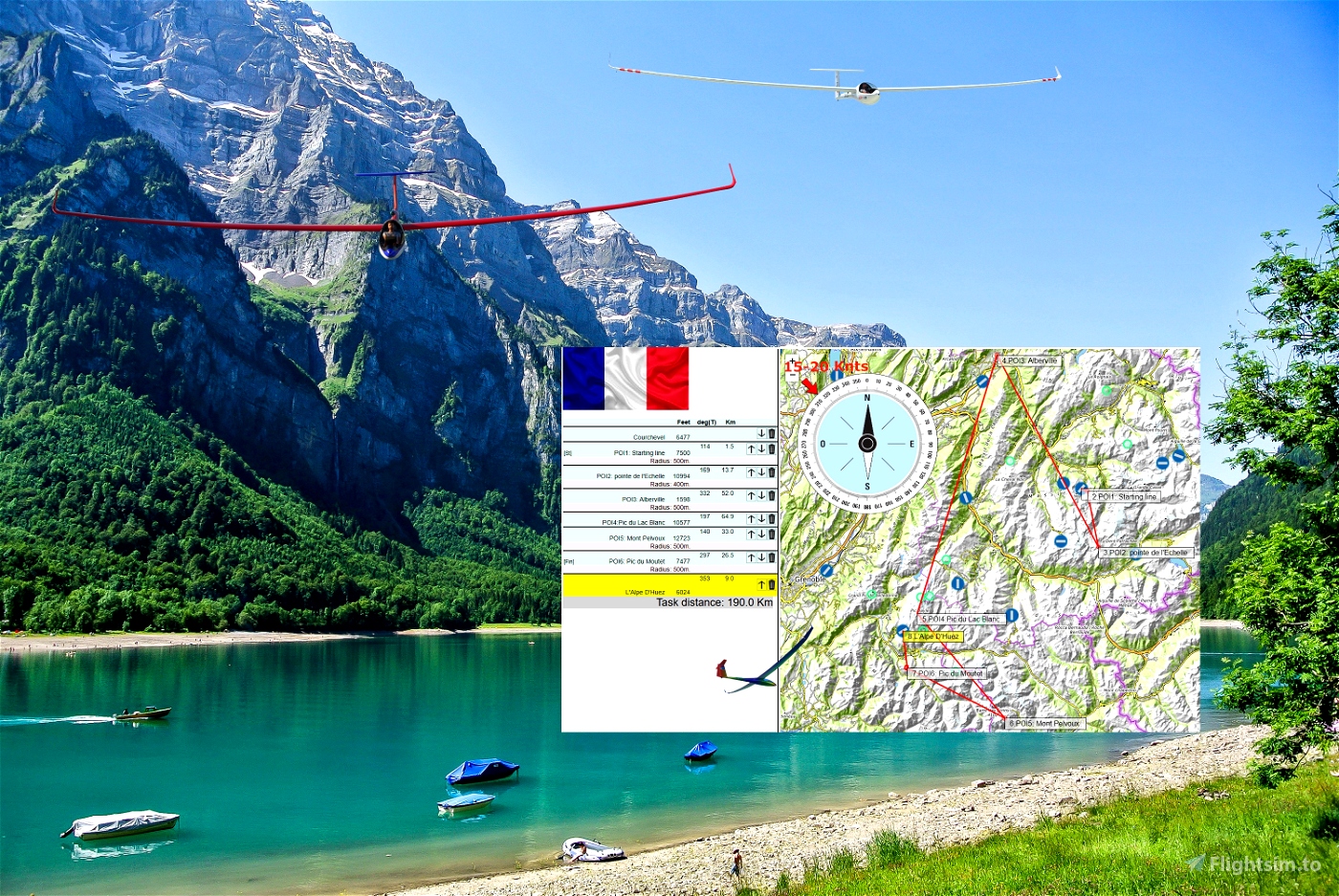
Glider ride on French Alpes with AS33me. You take off using your winch from LFLJ Courchevel airfield .
Courchevel
Departure: LFLJ
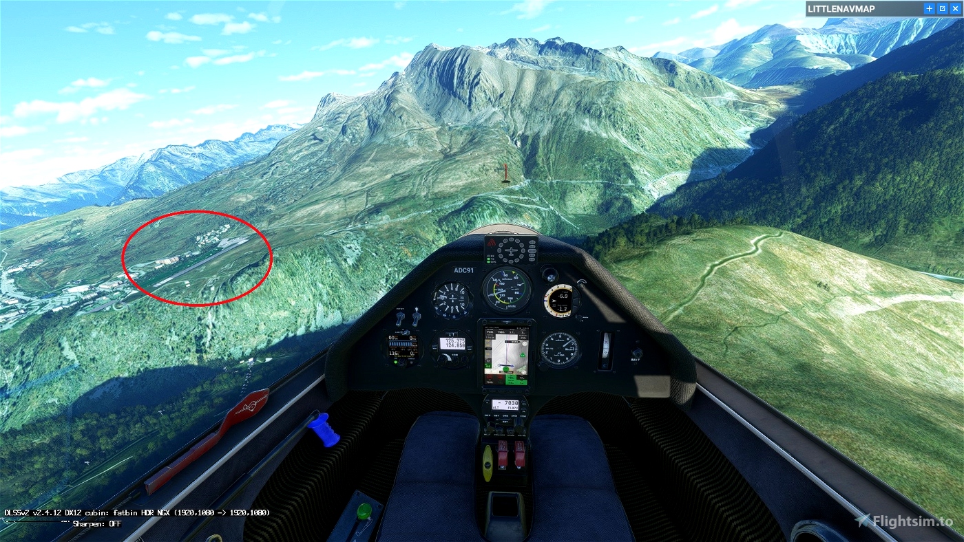
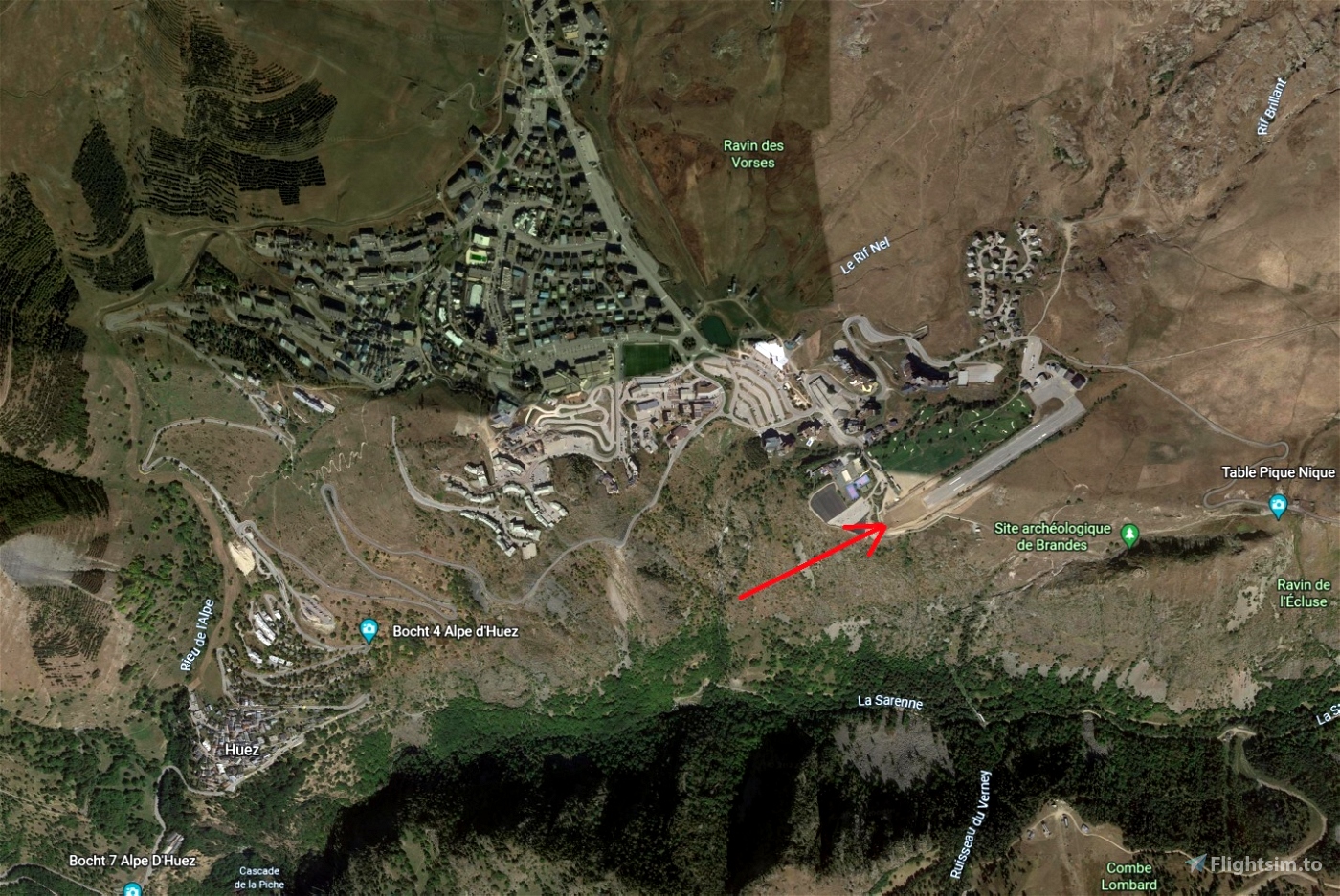
L'Alpe D'Huez
Destination: LFHU
Weather report:
Few clouds
---
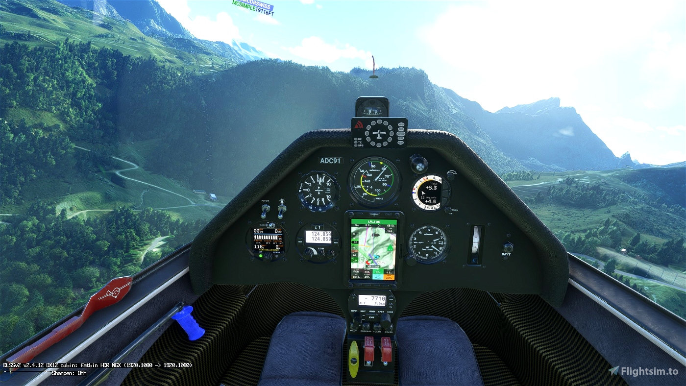
Use and look to GPS to validate all crossing points (notification when done).
Watch your GPS and wait for the map to finish loading.
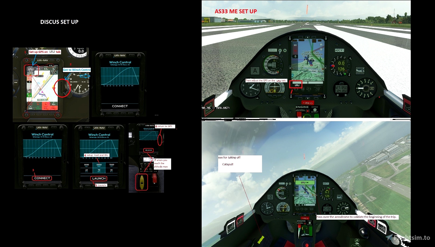
Then adjust the GPS on the LFLJ tab .
Use your catapult to take off. Pull on the yellow handle.
Use your engine to take off.
Use your WINCH to take off.
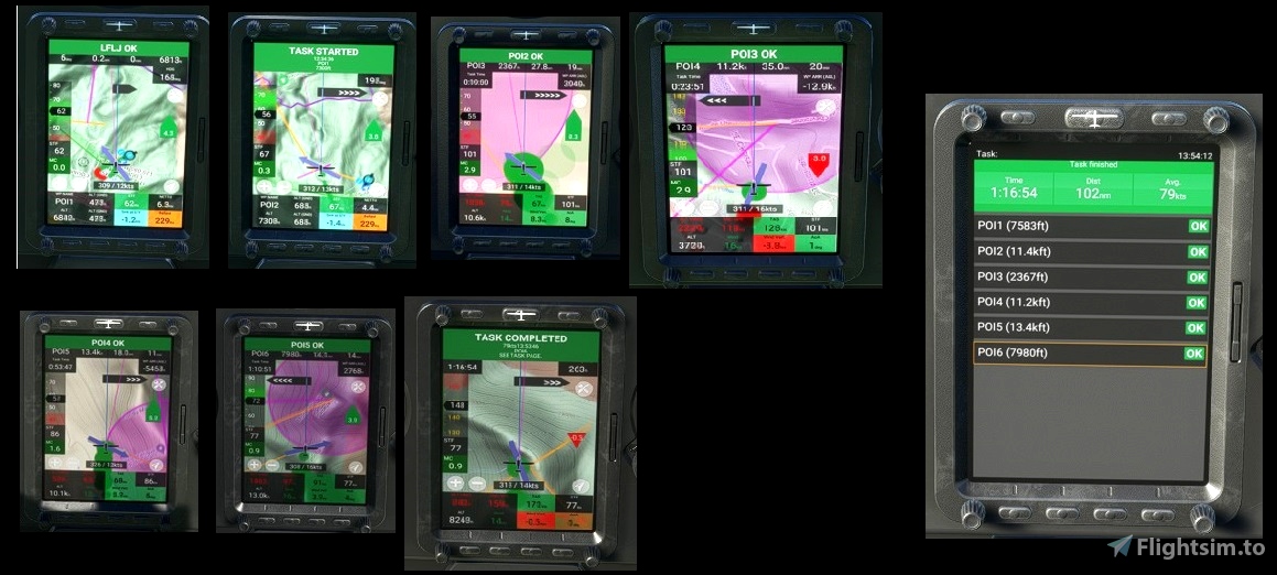
Pass over the aerodrome to valid LFLJ
When you have reached 2500 feet, turn right to unhook the cable and pass over the aerodrome.
Make sure that you have validated the crossing point above the aerodrome.
Use and look to GPS to validate all crossing points (notification when done).
Start your engine to reach 5 000 feet.
Maximum height to pass the POI1 start line.
----
---------------
LFLJ Courchevel 6477
OK go to POI1: Starting line. Elevation 7500 feet MAXI
OK go to POI2: pointe de l'Echelle Elevation 10994 feet
OK go to POI3: Alberville
OK go to POI4:Pic du Lac Blanc Elevation 10577 feet
OK go to POI5: Mont Pelvoux Elevation 12723 feet
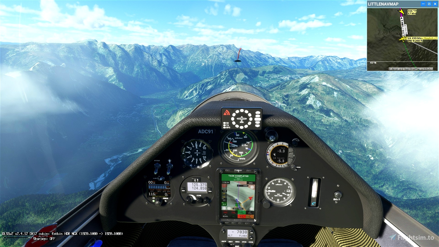
OK go to POI6: Pic du Moutet Elevation 7477 feet
go Landing on L'Alpe D'Huez Airport - LFHU 4259 feet
Turn off your main battery when you have landed
AS33 ME
https://fr.flightsim.to/file/15090/as-33-me
https://fr.flightsim.to/file/10113/helipad-lflj2
.

 ADCKillerman

