

Zambia Missing Airfields v0.2.1
===============================
Fancy some bush flying in Central Southern Africa? Look no further. I present you 12 Zambian airfields previously unavailable in MSFS. These are basic sceneries, but they have all the required starting locations (including a parking spot or two), a windsock, plus a few bits of bling to make them a little more interesting. I've also terraformed many of the runways to present realistic slopes.
As mentioned, none of the fields are currently included in MSFS, and most aren't even listed in the Ourairports database. Most of them, as far as I'm aware, don't have ICAO codes, so I made them up. The fields are as follows:
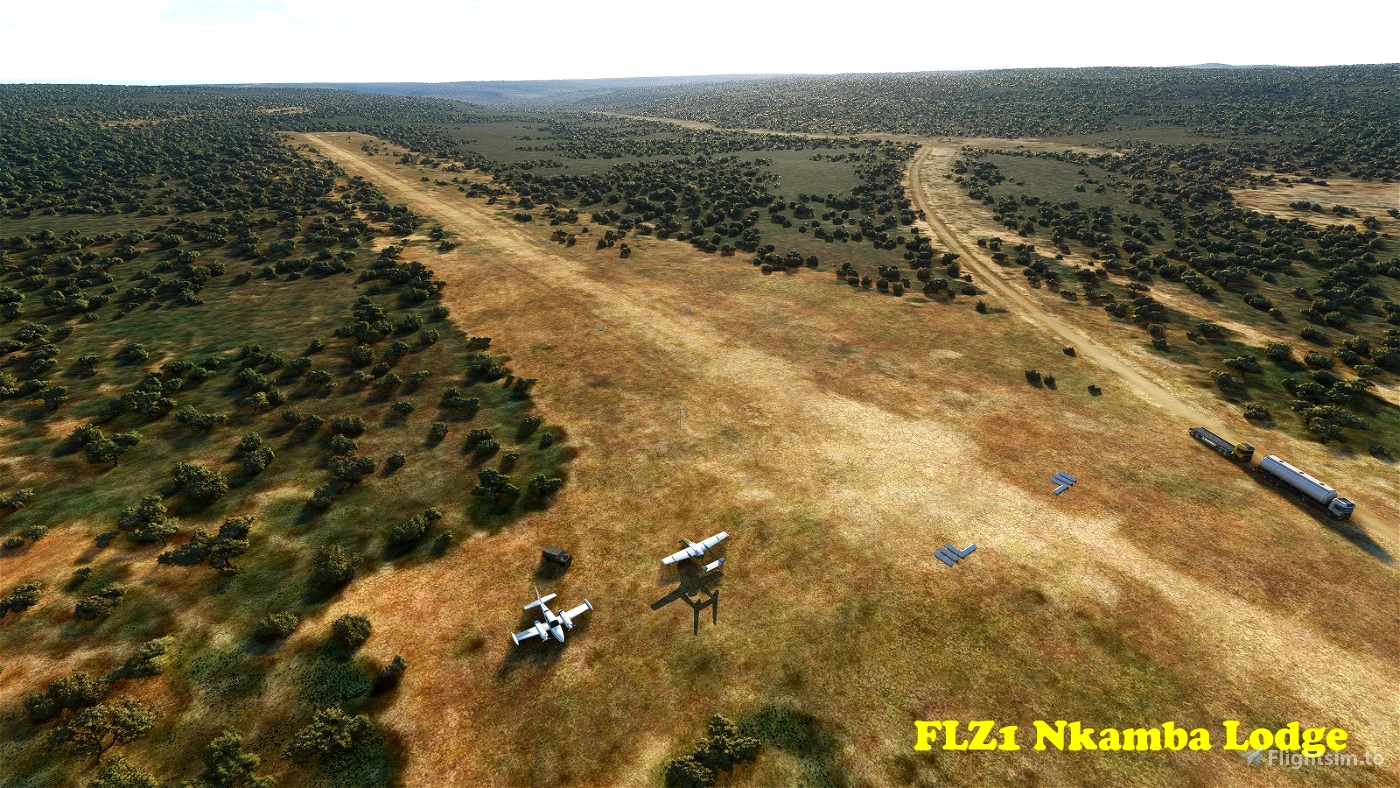
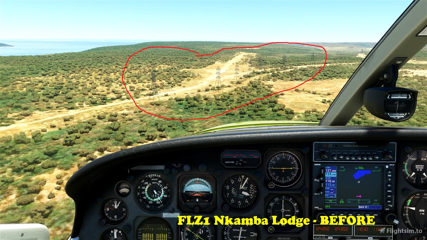
FLZ1 Nkamba Lodge
-----------------
Nkamba Bay Lodge is a Safari and Fishing Lodge on the shores of Lake Tanganyika in Northern Province. The airfield is located a mile and a bit to the east of the lodge. It has a 1,029m (3,376') long dirt runway that's oriented 06/24. Elevation is 2,864'. [Note: The real airfield may or may not have powerlines interfering with a clean approach to Runway 06. In MSFS without this mod there are 6 or 7 nasty looking high voltage towers "fencing off" Runway 06. They are clearly absent in real life (certainly no evidence on Google Earth), so I have removed them from the vicinity of the field.]
S 8°36'19" E 30°33'28"
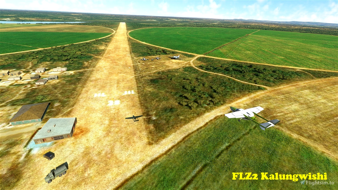
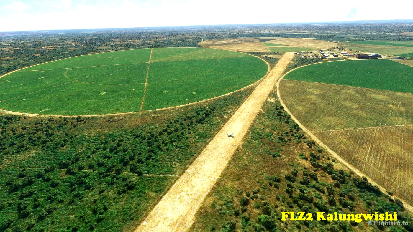
FLZ2 Kalungwishi
----------------
Kalungwishi field is located at an agricultural facility in Northern Province, near the village of Ngolo. It has a 1,235m (4,051') long dirt runway oriented 12/30. Elevation is 4,593'. [Note: Special thanks to colinj for the agricultural objects used in this scenery!]
S 9°52'42" E 31°13'3"
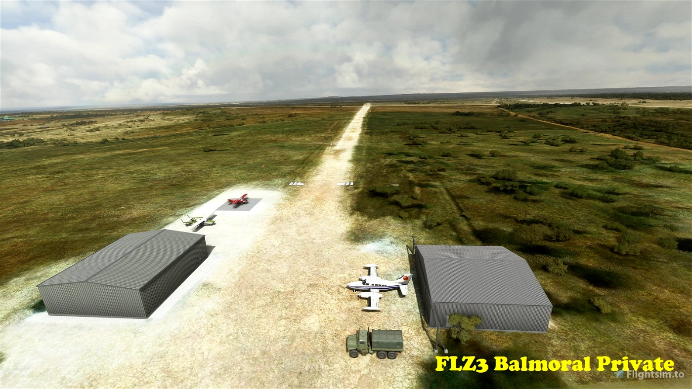
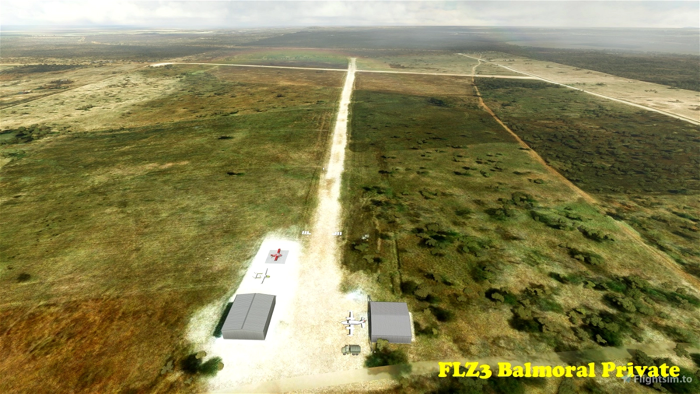
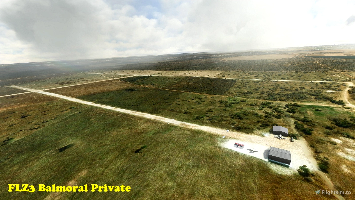
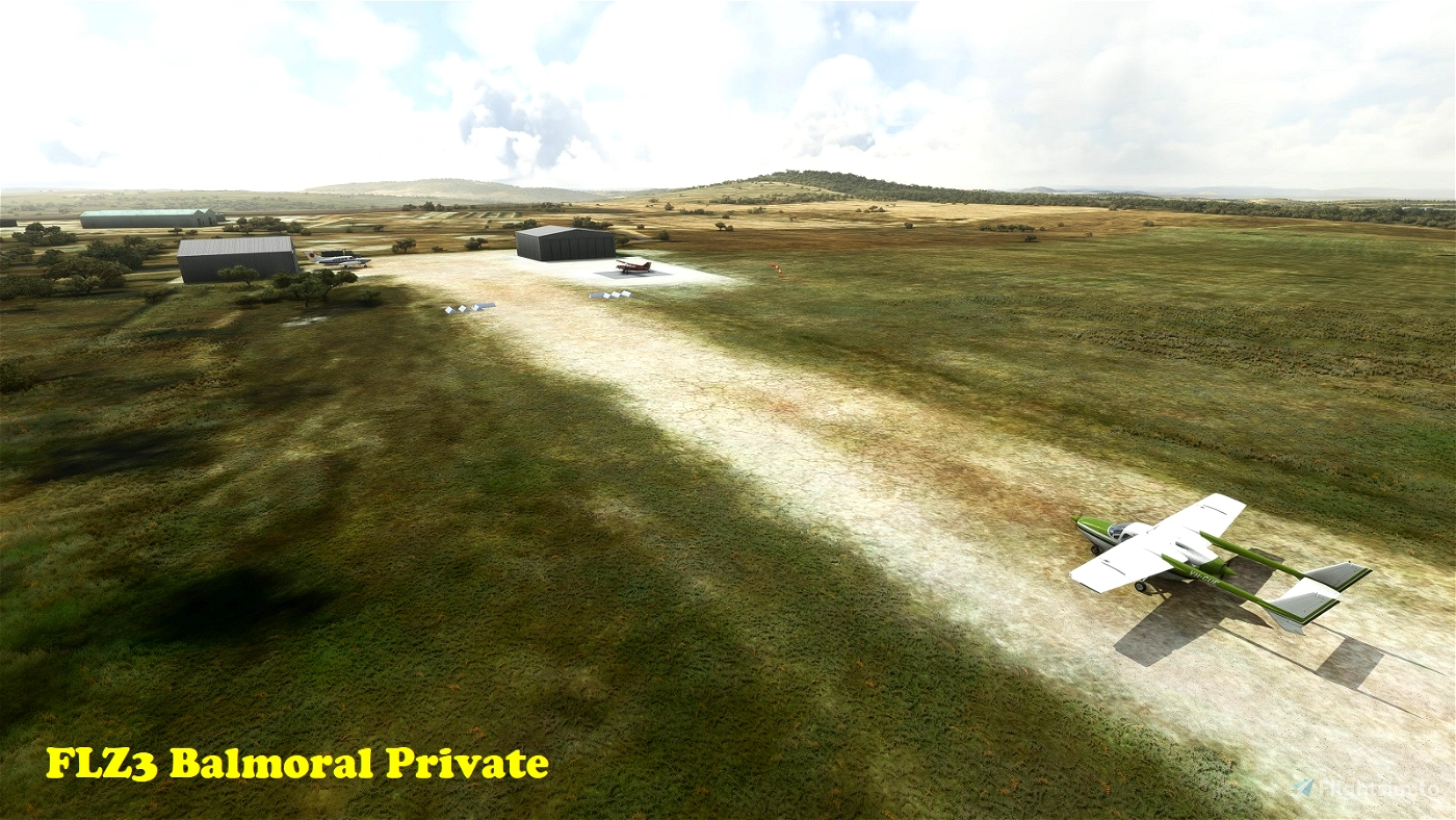
FLZ3 Balmoral Private
---------------------
This is a private airfield in Balmoral, on the south-western outskirts of the Zambian capital Lusaka. It has two dirt runways: Auxiliary 04/22 is 806m (2,644') long. The main 11/29 strip is 1,048m (3,438') long. Field elevation is 3980'. You will need the owner's permission to operate for this field!!!
S 15°32'48" E 28°11'40"
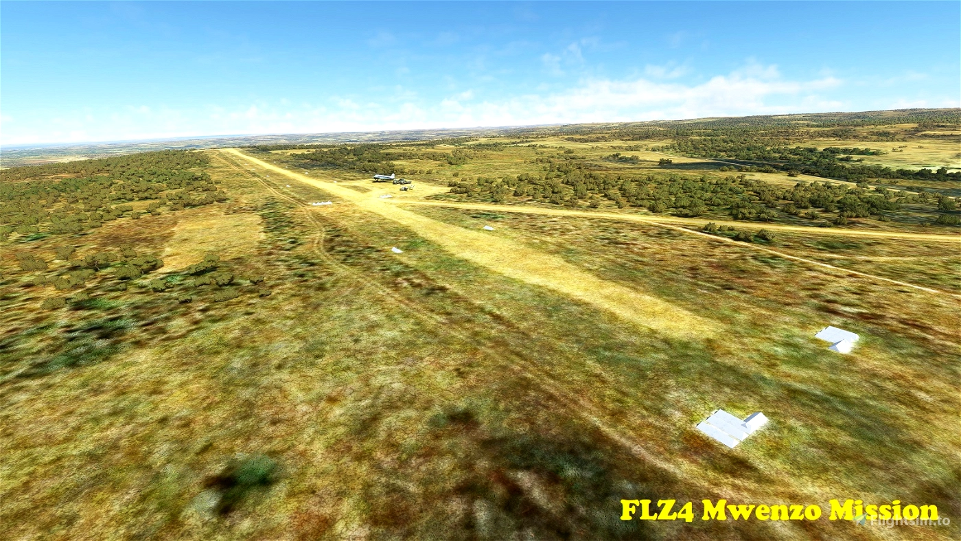
FLZ4 Mwenzo Mission
-------------------
This airfield is located near the village of Mwenzo in Muchinga Province close to the Tanzanian and Malawian borders. The dirt runway is located on a hilltop, is 1,125m (3,690') long and oriented 11/29. Elevation is 5,459'.
S 9°19'14" E 32°39'12"
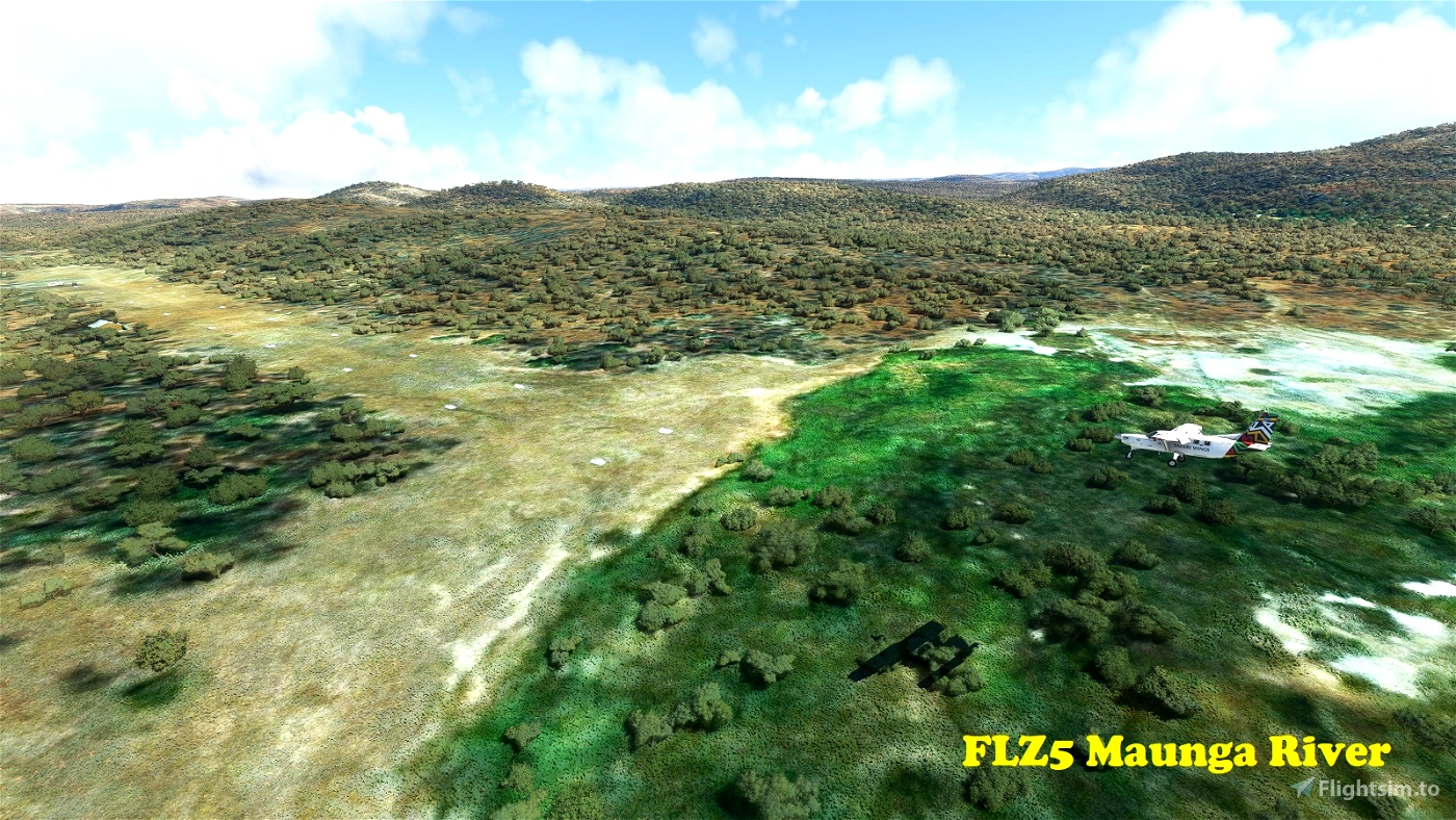
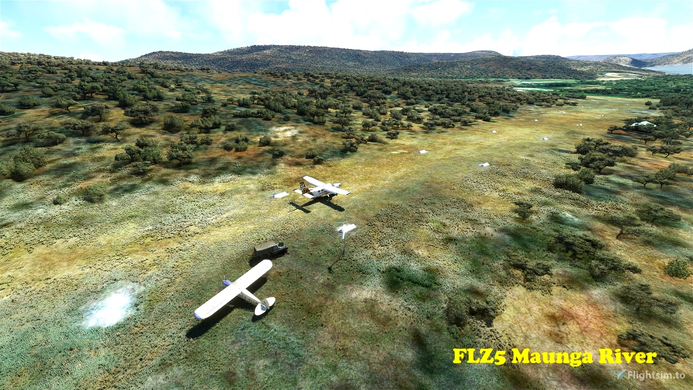
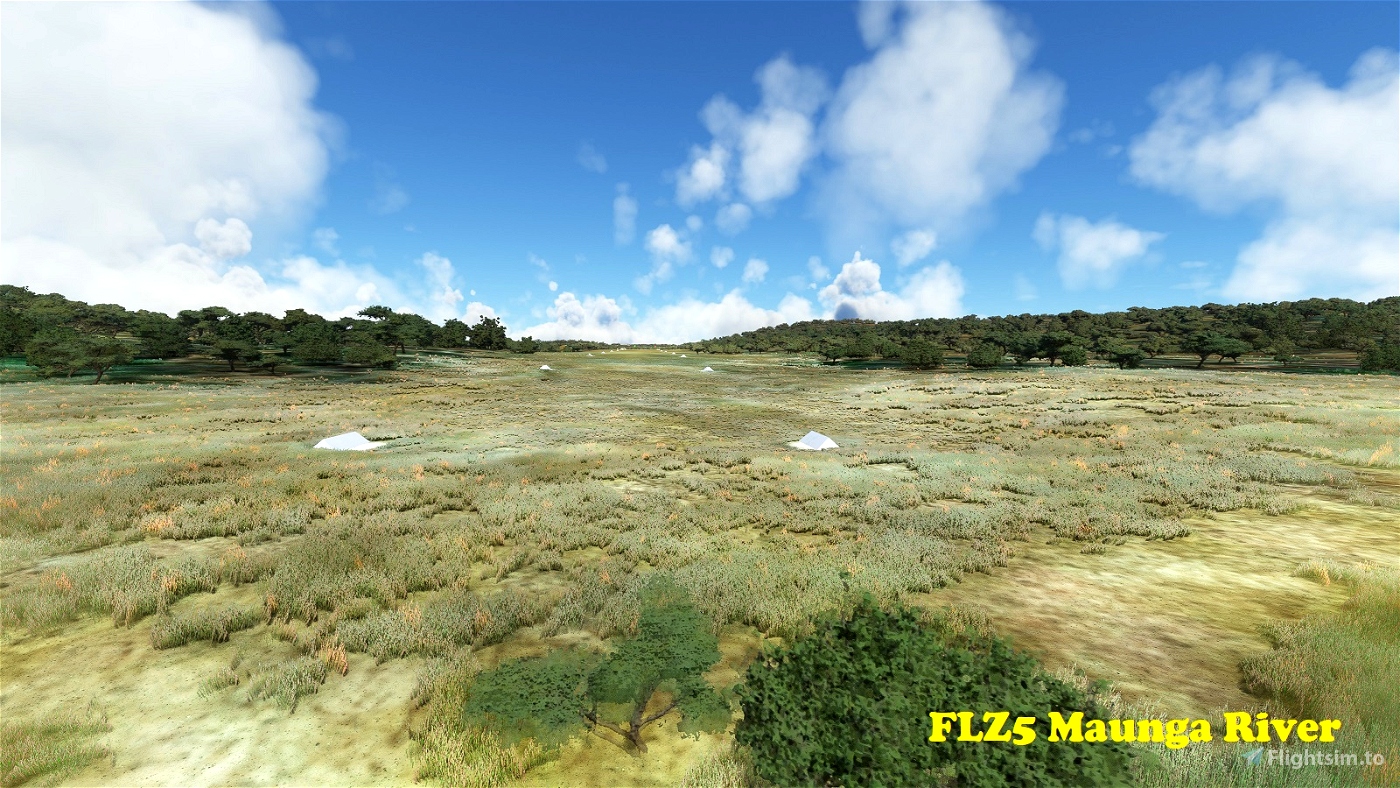
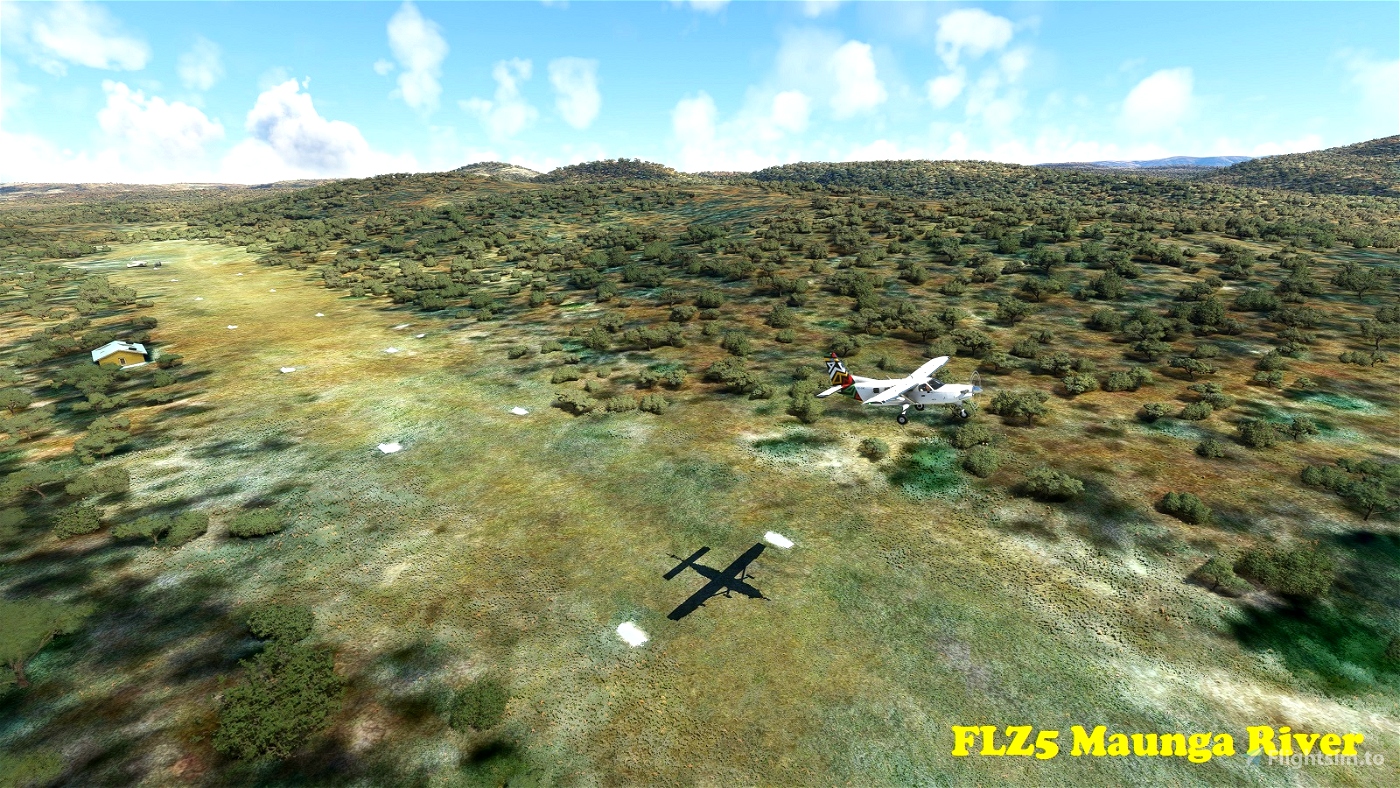
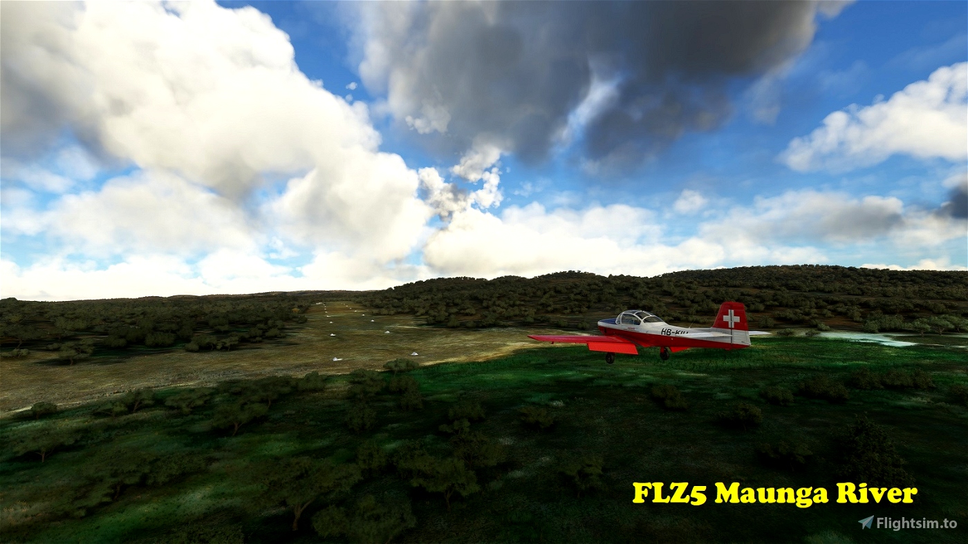
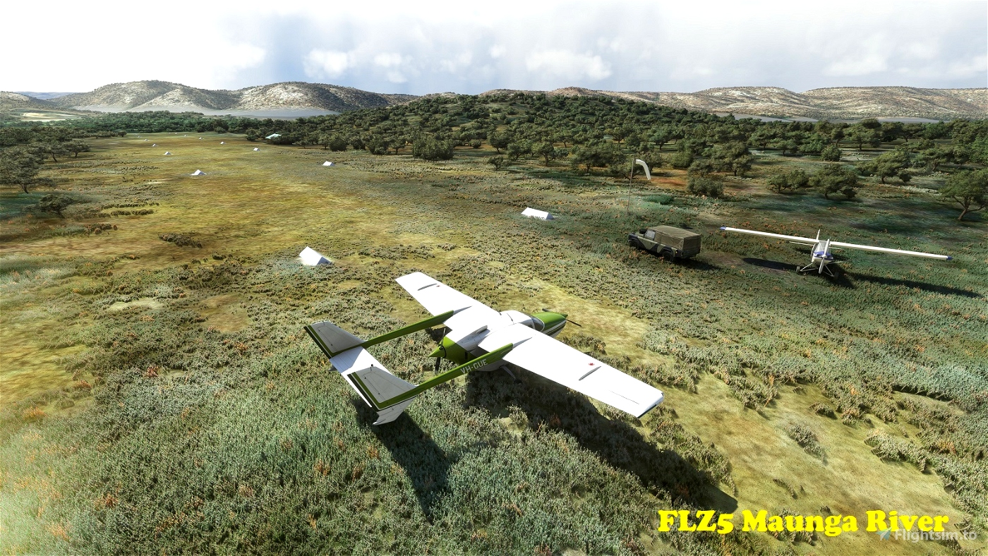
FLZ5 Maunga River
-----------------
The Maunga River is a tributary of the mighty Zambesi in Southern Province. The strip is located in a ravine near where the river joins the Zambesi. Caution: This is a short (401m, 1,315') one-way dirt strip with a moderate slope. Landing on Runway 29, take-off on Runway 11 only! You may want to conduct your first approach to this field from over the Zambesi River. Field elevation is 1,654'. [Update 0.2.0: The Zambesi has been extensively terraformed and water-masked in this scenery to fit its proper banks.]
S 18°0'59" E 26°44'37"
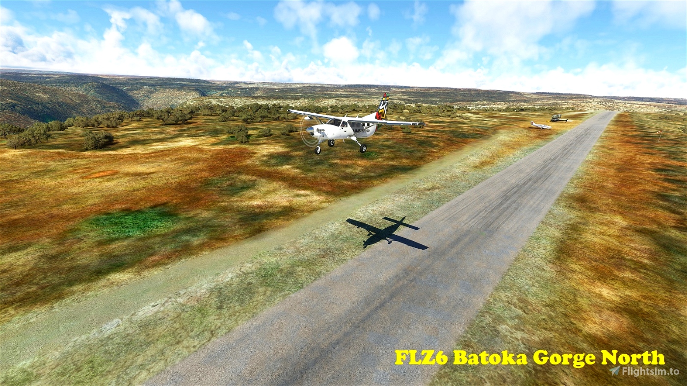
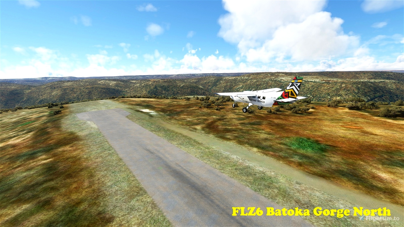
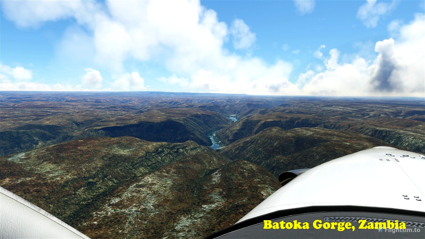
FLZ6 Batoka Gorge North
-----------------------
Located 35 nm upstream from Maunga River, on a high cliff-top overlooking the Zambesi as it rushes through Batoka Gorge. A rather spectacular omission from MSFS. The macadam runway is 791m (2,594') long and oriented 11/29. Be careful not to land short (even though the strip may look to have extended overruns). The terrain drops steeply from both runway ends. Field elevation is 2,848'.
S 17°55'6" E 26°6'11"
[Update 0.2.0: The following are new additions:]
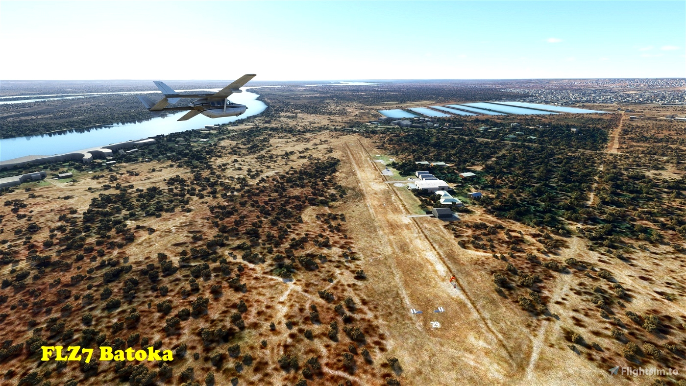
FLZ7 Batoka
-----------
Located on the southern outskirts of Livingston, Batoka airfield is primarily used for scenic helicopter and ultralight flights over Victoria Falls. The field consists of two rather short dirt strips: 11/29 with 435m (1,427') length, and 06/24 with 396m (1,300'). Field elevation is 2,943'. Given the short runway lengths and the generally hot conditions in this part of the world, density altitude must be given serious consideration! Also beware the drainage channel separating the strip from the aprons. If you are flying a light fixed wing aircraft rather than an ultralight or helicopter, you should park on the runway side of the drain.
S 17°53'5" E 25°50'50"
[Note: The default Victoria Falls in MSFS are a bit of a trainwreck! You may find the following mod by Pinepix will provide a somewhat more accurate representation: https:/flightsim.to/27304/victoria-falls-bridge]
FLZ8 Baobab Camp
----------------
2 Miles southeast of FLZ7 is another strip belonging to a Victoria Falls tourist operation. This one is brand new (built in 2021) and therefore lacks Bing aerial imagery. Runway 13/31 is a 997m (3,271)' long dirt strip. Facilities are limited, but there's an open-sided hangar for the operator's Caravan. Field elevation is 2,983'. [Note: As with FLZ1, MSFS models a high-voltage powerline adjacent to the airfield. While the corridor for a powerline exists in real life, the actual power line does not, so I have removed it from the sim.]
S 17°53'33" E 25°52'20
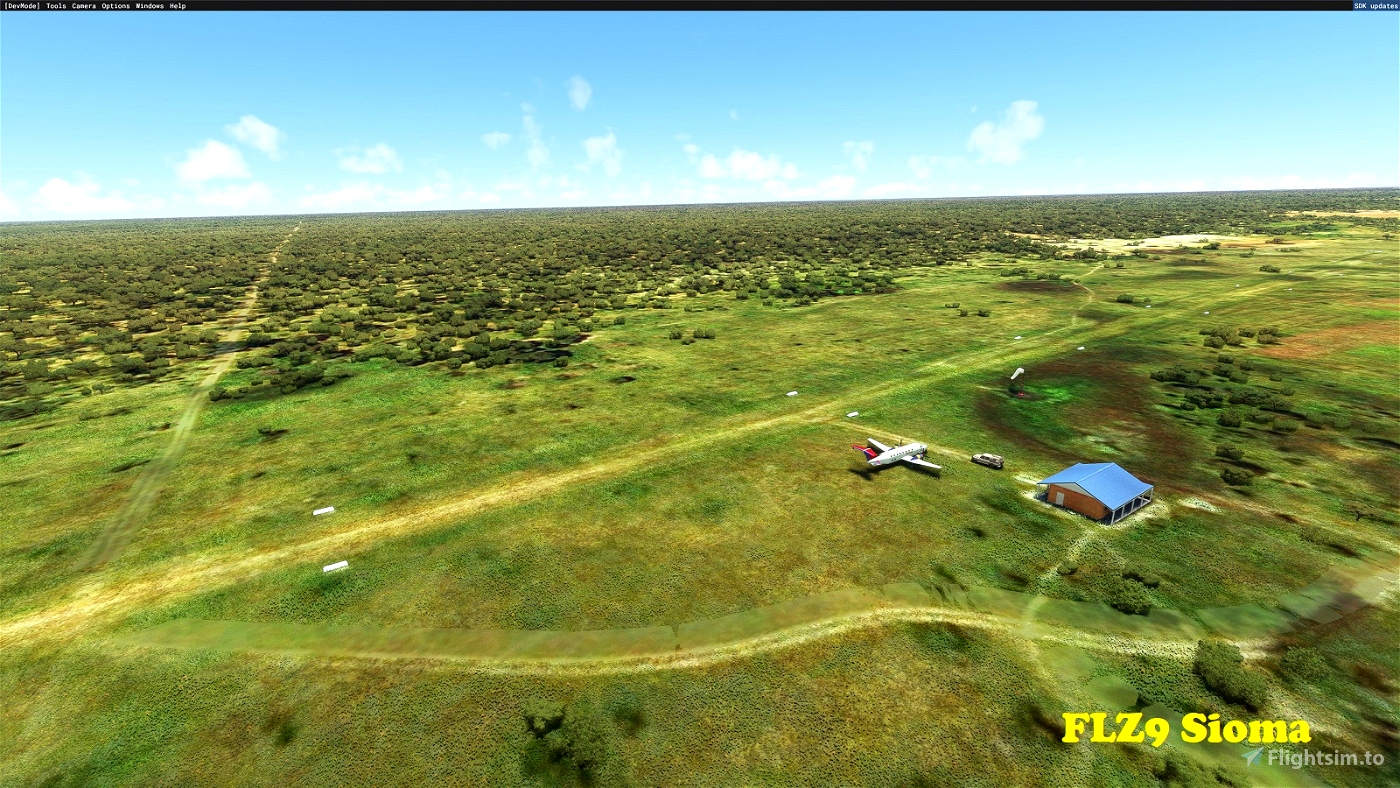
FLZ9 Sioma
----------
This strip is located near the village of Sioma, on the upper reaches of the Zambesi River, in Western Province. The dirt/grass (depending on season) Runway 09/27 is 1,205m (3,953') long. The approach to 27 leads over some powerlines (this time for real), so be mindful when landing towards the west. Field elevation is 3,276'.
S 16°41'40" E 23°36'50"
FLRO Rosa Mission
-----------------
A very basic strip in Northern Province. There are no facilities. Runway 13/31 is 1,000m (3,281') long and the surface is dirt. Field elevation is 5,228'.
S 9°31'35" E 31°14'14"
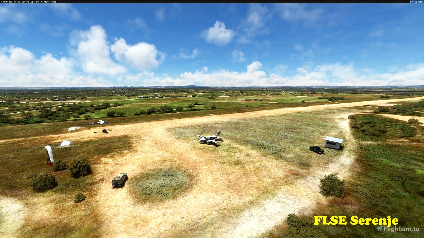
FLSE Serenje
------------
This basic airfield serves the town of Serenje in Central Province. Runway 07/27 is 915m (3,002') long and the surface is dirt. Field elevation is 4,649'.
S 13°11'54" E 30°14'20"
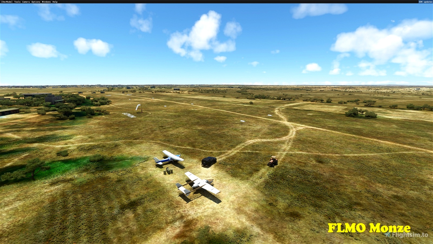
FLMO Monze
----------
This basic airfield serves the town of Monze in Southern Province. Runway 11/29 is 732m (2,401') long and the surface is dirt. Field elevation is 3,711'.
S 16°17'18" E27°30'24"
***BONUS*** FVZ1 Batoka Gorge South
-----------------------------------
While not technically a Zambian airfield, Batoka Gorge South is the Zimbabwean twin of FLZ6, located just across the Zambesi River. I've included it in this pack until someone creates a "Zimbabwe Missing Airfields" pack! The field is somewhat similar in all aspects to FLZ6, but narrower and a little shorter. So again, take extra caution at the runway ends! The 704m (2,309') long macadam runway is oriented 13/23 and field elevation is 2,812'.
S 17°55'56" E 26°7'2"
Installation:
=============
Simply copy the included folders into your Community folder. (If you are updating this scenery to a newer version, first delete the existing folders of the same name.)
Dependencies:
=============
To see the scenery objects I've placed, you will need to have the following object libraries installed:
MSFS 2020 object library with 190+ models ranging from towers hangars to cones by colinj
https://flightsim.to/file/16007/msfs-object-library-with-150-models-ranging-from-towers-hangers-terminals-to-cones
totof- aircraft library by Totof33120
https://flightsim.to/file/17182/totof-aircraft-library-v1-1
totof- helicopter library by Totof33120
https://flightsim.to/file/17983/totof-helicopter-library-v1
Mikea.at - Airport Markings by mikea.at
https://flightsim.to/file/4208/mikea-at-airport-markings
Dave's Crooked Library by BadMed
https://flightsim.to/file/4696/dave-s-crooked-library
Windy Things by trfsto
https://flightsim.to/file/14024/windy-things
AirHispania - Libraries by AirHispania
https://flightsim.to/file/5043/airhispania-libraries
Collection d'avions pour FS2020 by Jean-Pierre Fillion
https://www.jpfil.com/quebec-fs2020/scenes/Collection-avions.zip
Credit: Jean-Pierre Fillion, Quebec
quebec-fs2020.org
jpfil.com
Many thanks to the object developers for making the available to us!
[Note: the scenery will function without these libraries, but will look less interesting.]

 gunther


Good, now do the rest of Africa. lol
2 years ago
gryper
thank you, much appreciated !
2 years ago
darshonaut