Mountains
Download free Mountains Sceneries for Microsoft Flight Simulator. Verbeter je virtuele vliegwereld met de Scenery-uitbreidingen van Flightsim.to voor Microsoft Flight Simulator. Duik in een wereld van adembenemende landschappen en gedetailleerde omgevingen, gemaakt door een toegewijde community. Verhoog je vliegervaring met deze meeslepende downloads.

Mont Aigoual with Helipads
Le Mont Aigoual est un sommet au bord du sud du Massif central, situé sur la commune de Valleraugue dans...

Mont Bessou
Le Mont Bessou est un sommet du Massif central, situé sur la commune de Meymac, en Corrèze. Avec 977 m...

Puy De Dome
Without antenna the old french volcano is not real so i did it. GPS : 45.77253, 2.96451 INSTALLATION : Remove...
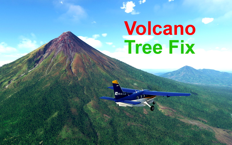
Volcano Tree Fix (global)
This mod improves and/or removes vegetation on volcanos around the globe.Now, not all volcanos ;). Only the ones I have...


Cooma Airport, Snowy Mountains, Australia NSW, YCOM
Cooma Airport Snowy Mountains NSW is the Gate way to the Snowys, Near by is Mt Kosciuszko 2228 m Australias...


Chamonix-Mont-Blanc, Rhône-Alpes, France - Valley
Chamonix-Mont-Blanc, Rhône-Alpes, France (19 cm/textel). Valley only. Include CMBH DZ at Argentière (semi-fictional). You can extend this scene using Chamonix-Mont-Blanc...


Chamonix-Mont-Blanc, Rhône-Alpes, France - Mountains
Chamonix-Mont-Blanc, Rhône-Alpes, France (19 cm/textel). Mountains only. Before downloading, please check the minimum system requirements: see the "Disclaimer" section. You...

Montagne de Sainte Baume
EN -- Montagne Sainte-Baume, this is the first version, there is just the texture for now but for users who...


Japanese POI series "Famous 100 Mountains in Japan" Ver. 0.2.1
Japanese POI series "Famous 100 Mountains in Japan" Version 0.2.1 Aug. 27,2022 Improved the location accuracy in accordance with Wikipedia.Delete...


AZORES (PORTUGAL) IMPROVEMENTS -fix for ts LPLA and mk studios LPPD ( old file still available)
AZORES-PORTUGAL !!! none of this is supossed to be 100 % accuarate this is more of a improved default scenary...


Mt-Bélair_Quebec_tours éclairés
La version 1.2 améliore l'apparence et offre une vue plus réaliste des tours. Tours du Mont-Bélair, Québec Canada. Cette scène...

Saxon Switzerland - Rathen
Saxon Switzerland - Rathen - Introduction The Elbe Sandstone Mountains, better known as Saxon Switzerland, are probably the most imposing...

LFTS - La Tovière Val d'Isère
Hello Pilot friend, I continue in my creations to present LFTS La Tovière Val d'Isere to you. It is an...


LICJ - MONTAGNA LONGA - PUNTA RAISI
MONTAGNA LONGA - PUNTA RAISI (LICJ)coordinate: 38°07′34.09″N 13°08′52.5″Ewith the update of Flightsimulator to version 1.12.0 Montagna Longa, ie the mountain...

