


This 93 nautical mile route takes in the eleven highest peaks of northern England's Yorkshire Dales National Park in a clockwise order from the south. I’ve included the flight plan in both MSFS (.pln) and Little Navmap (.lnmpln) formats.
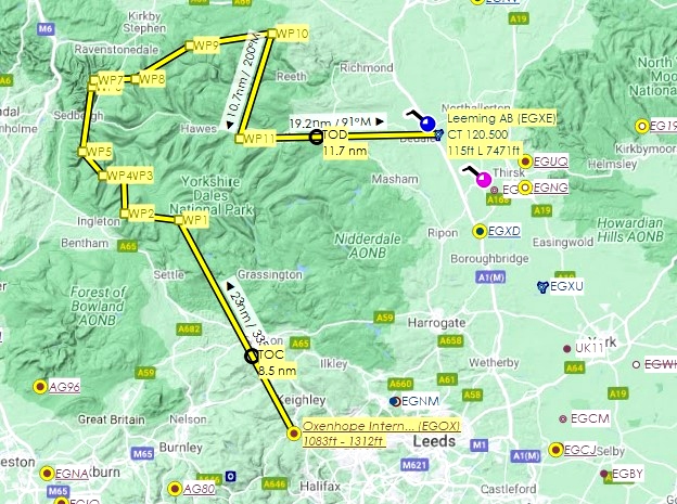
We take off from Oxenhope (EGOX) near Bradford. From there, the directions, distances and peak elevations:
- 23 nm northwest to Pen-y-ghent (594 m / 1949 ft)
- 5.3 nm west to Ingleborough (723 m / 2372 ft)
- 3.7 nm north to Whernside (736 m / 2414 ft)
- 2 nm west to Green Hill (626 m / 2053 ft)
- 3 nm northwest to Calf Top (609 m / 1998 ft)
- 64 nm north to Cautley Spout waterfall (400 m / 1312 ft)
- 0.7 nm northeast to Yarl (639 m / 2096 ft)
- 3.9 nm east to Wild Boar Fell (708 m / 2322 ft)
- 6.2 nm northeast to Old Side Top (573 m / 1879 ft)
- 8.1 nm east to Hoove (554 m / 1817 ft)
- 10.7 nm south to Addlebrough (476 m / 1561 ft)
We land 19.2 nautical miles east of Addlebrough at RAF Leeming (EGXE).
A safe altitude for the journey is 3,500 feet, but try to land on at least a couple of the peaks and take in the views. Addlebrough, for one, has a relatively flat top.

 newtestleper

