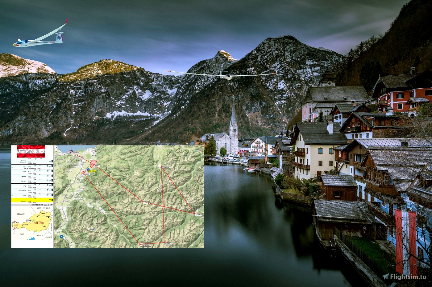
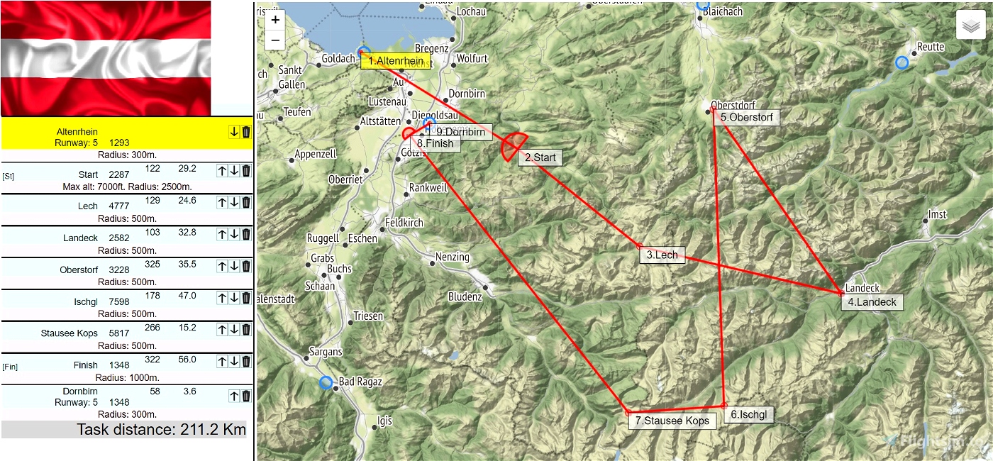

From Altenrhei-LSZR To Dornbirn-LOIH.
Distance: 224 km . .
.
Length: 1 - 1.5 h
Difficulty: Medium / Advanced
Pass POI1 "Start" point at 6 000 Feet MAX for best challange.We are crossing the Alpes mountains.
when you are on the runway.
Watch your GPS and wait for the map to finish loading.
Then adjust the GPS on the LSZR tab. View screenshots
Use you engine to take off.
Pass over the aerodrome to validate the beginning of the trip.
Use and look to GPS to validate all crossing points (notification when done).
POI1: Starting line.Elevation 6175.Altidude Maxi 6 000 feet for the best challenge
POI2: Embalse de Escarra. Elevation 5285 feet
POI3: Landeck Reservoir. Elevation 2582 feet
POI4: Oberstorf. Elevation 3228 feet
POI5: Ischgl. Elevation 5459 feet
POI6: Stausee Kops. Elevation 5817 feet
POI7: Finish line.Elevation 1348 feet
Landing at Dornbirn - LOIH 1348 feet
Turn off your main battery when you have landed
Georg Ortner is the autor of the flight plan and weather
https://discord.com/invite/8TaW8QjH
https://www.youtube.com/GeorgOrtner
https://www.twitch.tv/videos/1534299342
when you are on the runway.
1-You must also set the GPS on the tap where there is the LSZR
View screenshots
Recommended Mods:
DG808s
https://fr.flightsim.to/file/30384/dg-flugzeugbau-dg-808s
lxn-dg808s
Replacement mod for the Touching Cloud DG808s Nav computer
https://github.com/JackBilbo/lxn-dg808s
or
DG808S - LXN Nav Replacement » Microsoft Flight Simulator
Keybinds
Several functions can be operated by keybinds from joystick or throttle:
Page left/right: INCREASE/DECREASE COM1 (WHOLE) Page up/down: INCREASE/DECREASE COM1 (FRACT)
Waypoint next/prev: INCREASE/DECREASE TRANSPONDER (1000) Map Zoom: INCREASE/DECREASE TRANSPONDER (10)
Map Orientation: INCREASE/DECREASE TRANSPONDER (1)

 ADCKillerman


Thank you!
1 years ago
Ginete