


4R9-Jeremiah Denton Airport -Dauphin, Alabama Located 00 miles NW of Dauphin Island, Alabama on 22 acres of land.
In real life I don't think is has fuel, but the airport says it has it. fuel 100 blue.
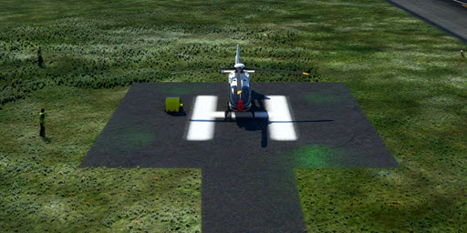
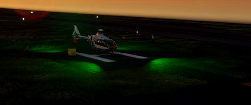
- added helipad with lights
- added lights to the fuel station
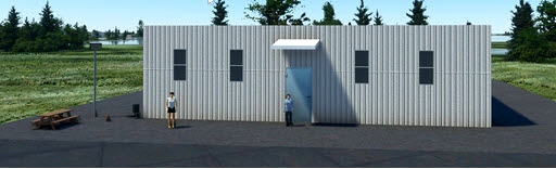
- added a office building
- I added a lot of other things you might like to see.
There is an offshore oil drilling rig off the coast you might like to visit, take your helicopter. It can be found at: 27° 31' 31.16" N 87° 25' 10.40" on a heading for about 169 deg south of the airport. It is about a 195 miles.
Other Remarks
BIRDS ON & INVOF ARPT.
EXTSV BANNER TOW OPNS ARND IS CST LN & N TO MOBILE.
Nearby Airports with Instrument Procedures
ID Name Heading / Distance
St Elmo Airport 2R5 St Elmo Airport 332° 16.4
H L Sonny Callahan Airport KCQF H L Sonny Callahan Airport 047° 17.7
Mobile Downtown Airport KBFM Mobile Downtown Airport 007° 22.1
Jack Edwards Ntl Airport KJKA Jack Edwards Ntl Airport 085° 23.7
Trent Lott International Airport KPQL Trent Lott International Airport 300° 24.1
Foley Municipal Airport 5R4 Foley Municipal Airport 065° 24.3
Mobile Regional Airport KMOB Mobile Regional Airport 346° 26.5
Bay Minette Municipal Airport 1R8 Bay Minette Municipal Airport 023° 39.8
Keesler AFB Airport KBIX Keesler AFB Airport 282° 42.3
Pensacola NAS/Forrest Sherman Field Airport KNPA Pensacola NAS/Forrest Sherman Field Airport 082° 42.4
Gulfport-Biloxi International Airport KGPT Gulfport-Biloxi International Airport 280° 49.7
Pensacola International Airport KPNS Pensacola International Airport 075° 50.5

 rcla39652

