


Specially for VFR flying Netherlands.
Arnhem Landmarks.
Note editor:
Don't be to hard on me.. This one was though, based on a lot of levels in it. High ground around the rails, trainstation building different kind of levels on th e ground. pffff.....So I hope you like it..
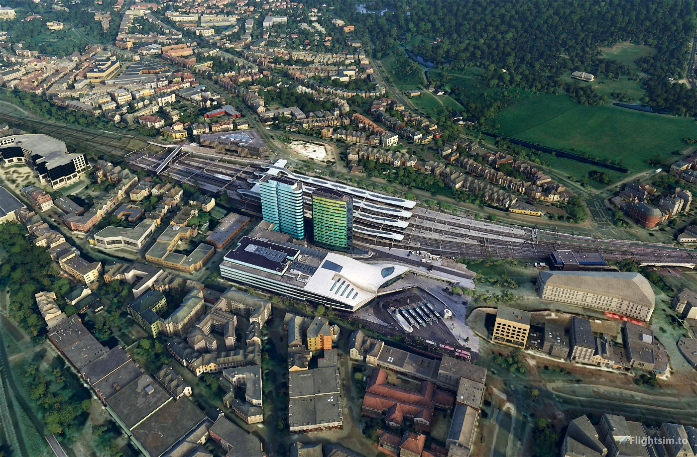
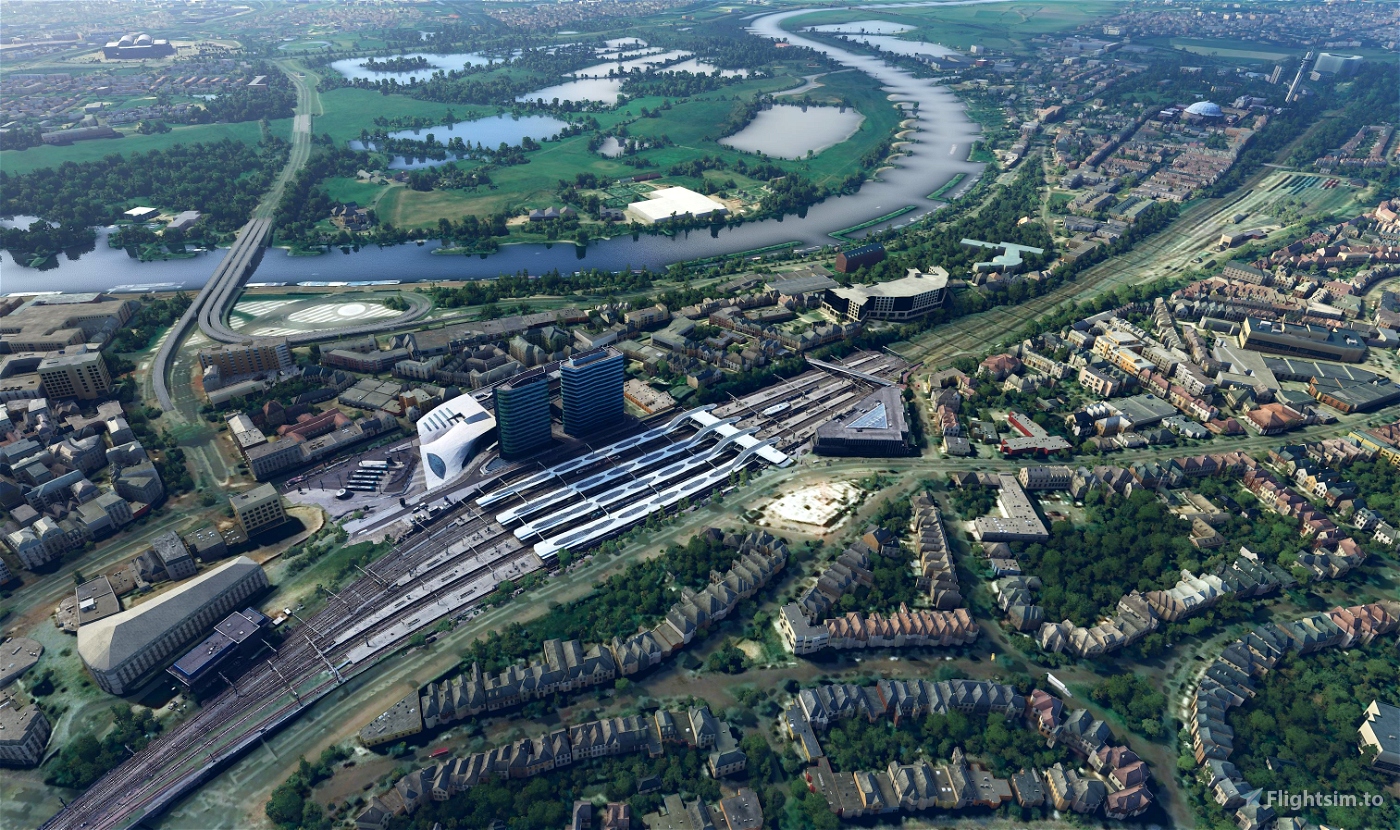
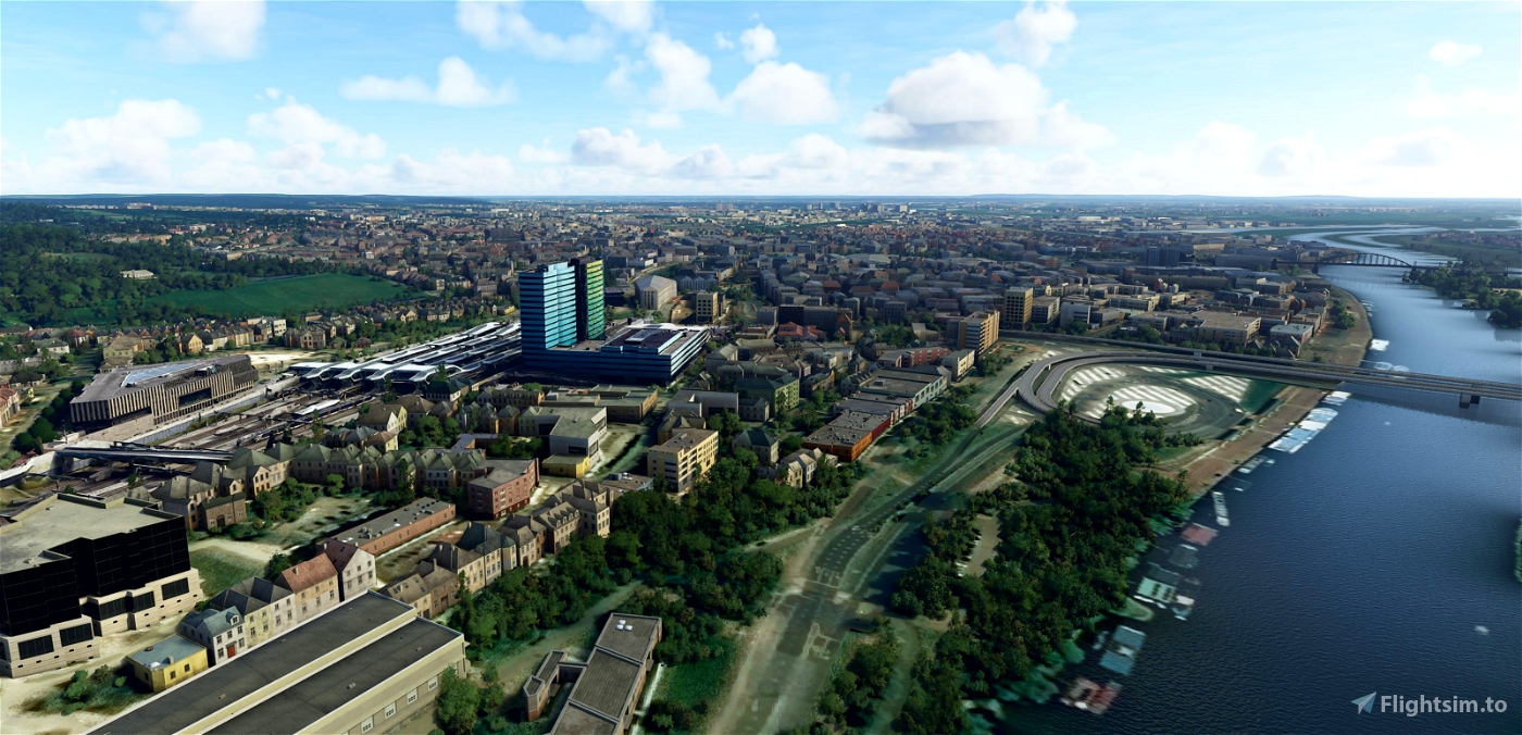
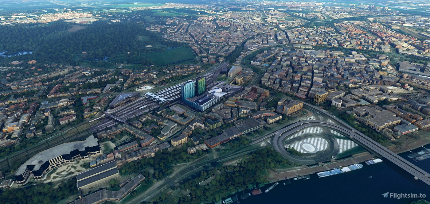
Arnhem Centraal railway station
Arnhem Centraal railway station is the largest railway station in the city of Arnhem in Gelderland, Netherlands. It was opened on 14 May 1845 and is located on the Amsterdam–Arnhem railway, the Arnhem–Leeuwarden railway and the Arnhem–Nijmegen railway. The station opened at the same time as the Amsterdam–Arnhem railway, that continues into Germany via the Oberhausen–Arnhem railway.
The station is the main station of Arnhem, and at present, has around 40,000 passengers that use the station per day, this makes it the 9th busiest station in the Netherlands. The main building has a surface of 18,000 m2 and a volume of 76,000 m3, the building has a capacity of 110.000 transfers per day.
In 2006 a reconstruction of the complete station area started. In October of that year, a temporary station entrance opened, that could only be reached by three sets of stairs (or by elevators). On July 2, 2011, a new tunnel under the platforms opened. The temporary entrance closed down and dismantled in the Autumn of 2011. As of that period the railway consists of 4 platforms including a footbridge connecting all platforms.
During the summer of 2011 a new dive under was created west of the station which allows trains to Nijmegen and Utrecht to underpass all tracks without interfering the other train services. All traffic on the western part of the station was completely suspended during 5 weeks. Drive under officially opened on the 29 of August in 2011. The official re-opening of the completed station was on 19 November 2015, on this day the station was renamed Arnhem Centraal, formerly it had just been Arnhem.
The new design of the railway station was created by UNStudio[2] in collaboration with Cecil Balmond at Aurp AGU. It won the Dutch Nationale Staalprijs.
(source Wikipedia)
-----------------------------------------------------------
File credits
This free creation contains content from Google Maps or Google Earth. In accordance with Google Terms of Services and especially point 2.2 of Google Maps/Google Earth Additional Terms of Service, this creation is based on « fair use » or « fair dealing » of the data provided by google throught its services. No commercial use or any gain is or will ever be made by the author of this creation, who doesn’t own anything regarding google assets but a simple user Licence. According to the following document https://www.google.com/intl/en-GB/permissions/geoguidelines/, the author is freely sharing a creative application of Google Maps or Google Earth. The author will not recieve any form of retribution for sharing his work, even general donations from users of file hosting web services under the form of « rewards » or « tips ». If this content would be found somewhere where it is provided in exchange of money or any kind of retribution, I wouldn’t be with the consent of the author who will stick to strict free content creation diffusion.
Part of this content including 3d data and textures is copyrighted by
Imagery ©2020 Google, Imagery ©2020 CNES/ Airbus, Maxar Technologies,
USDA Farm Service Agency, Map data ©2020 Google.

 Geraldar98


Hello.
I have come across a number of your epic asset creations and have the same question for them all.
Am I able to use these alongside some addon city? For example, I have a custom made Arnhem addon installed that covers the whole city. Will adding this building cause any problems do you think?
1 years ago
LeadNarrator
4 years ago
simbanl
4 years ago
MiB
4 years ago
SjoerdtenBrau
4 years ago
jpht64
Thank you!
4 years ago
PHMAC
We're very fortunate to have our own 'Orangeshark.ai' developers for our country in this continuous degrading sim (by every update..)
All of you guys doing a great job in creating and filling up the 'gaps' the first party forgot or...wasn't capable to implement. Every Flightsim is dependent to 3rd party devs so far to make it better an that's what you guys continually deliver.
Thumbs up, 5 stars, great job!
4 years ago
ConVair880